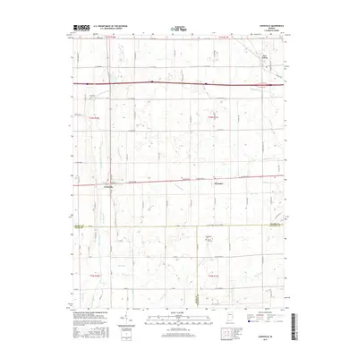
2016 Map of Lewisville
USGS Topo · Published 2016About this map
Lewisville and Straughn sit along the historic National Rd corridor in this mid-2010s survey of the eastern Indiana borderlands. The landscape is defined by its rectilinear grid of county roads and a complex network of agricultural waterways, including Mercer Ditch, Glidden Ditch, and Hall Ditch, which drain the fertile plains between the Flatrock River and Symons Cr. For local historians and genealogists, the map preserves the location of several small burial grounds such as Ebenezer Cem near the river and Shanee Bluff Cem to the south. The intersection of local county roads like N Wilbur Wright Rd and the throughways of the interstate era illustrate the evolution of transit in this rural region near the Henry and Rush County line.
Find a feature on this map
82 named features on this map. Tap any name to fly to it.
Don’t see what you’re looking for? This feature index may not catch every label — zoom into the map to look around manually.
Map Details
Editions of this 2016 Lewisville Map
This is the sole edition of this map. No revisions or reprints were ever made.
Other maps of this area

1948 · Lewisville
USGS Topo · 1:24,000

1949 · New Castle West
USGS Topo · 1:24,000

1950 · New Castle East
USGS Topo · 1:24,000

1950 · Dunreith
USGS Topo · 1:24,000

1950 · Lewisville
USGS Topo · 1:24,000

1953 · Cincinnati
USGS Topo · 1:250,000

1956 · Connersville
USGS Topo · 1:24,000

1957 · Cincinnati
USGS Topo · 1:250,000

1959 · Mays
USGS Topo · 1:24,000

1959 · Falmouth
USGS Topo · 1:24,000