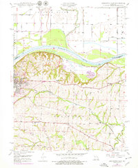
1949 Map of Lexington East
USGS Topo · Published 1978About this map
Lexington rises above the south bank of the Missouri River, serving as a focal point for commerce and education in Lafayette County. The influence of the Wentworth Military Academy is prominent on the western edge of town, while the surrounding landscape reveals a deep history of coal extraction, evidenced by several Mine Dumps scattered through the hills. This 1949 survey illustrates the vital role of the Missouri Pacific railroad, which skirts the bluffs and connects the river bottoms to the upland settlements.
Find a feature on this map
24 named features on this map. Tap any name to fly to it.
Don’t see what you’re looking for? This feature index may not catch every label — zoom into the map to look around manually.
Map Details
Editions of this 1949 Lexington East Map
3 editions found
Other maps of this area

1889 · Lexington
USGS Topo · 1:125,000

1949 · Mayview
USGS Topo · 1:24,000

1949 · Lexington East
USGS Topo · 1:24,000

1949 · Lexington West
USGS Topo · 1:24,000

1949 · Odessa North
USGS Topo · 1:24,000

1950 · Lexington East
USGS Topo · 1:24,000

1950 · Mayview
USGS Topo · 1:24,000

1950 · Odessa North
USGS Topo · 1:24,000
1950 · Lexington West
USGS Topo · 1:24,000

1950 · Dover
USGS Topo · 1:24,000