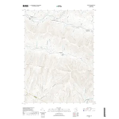
2019 Map of Lexington
USGS Topo · Published 2019About this map
Schoharie Creek defines the northern reaches of this landscape, winding past the village of Lexington and through the valley floor near Jewett Center. The terrain is characterized by high peaks and narrow hollows, where the Greene Co and Ulster Co line traverses the southern ridges. Small settlements like Spruceton are anchored by local landmarks such as the Spruceton Methodist Church Cem, reflecting the area's long-standing rural community structure.
Find a feature on this map
63 named features on this map. Tap any name to fly to it.
Don’t see what you’re looking for? This feature index may not catch every label — zoom into the map to look around manually.
Map Details
Editions of this 2019 Lexington Map
This is the sole edition of this map. No revisions or reprints were ever made.
Other maps of this area

1892 · Kaaterskill
USGS Topo · 1:62,500

1893 · Kaaterskill
USGS Topo · 1:62,500

1893 · Durham
USGS Topo · 1:62,500

1894 · Kaaterskill
USGS Topo · 1:62,500

1894 · Durham
USGS Topo · 1:62,500

1899 · Kaaterskill
USGS Topo · 1:62,500

1900 · Phoenicia
USGS Topo · 1:62,500

1901 · Gilboa
USGS Topo · 1:62,500

1903 · Gilboa
USGS Topo · 1:62,500

1903 · Phoenicia
USGS Topo · 1:62,500