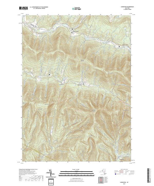
2023 Map of Lexington
USGS Topo · Published 2023About this map
Lexington and Jewett Center sit along the upper reaches of Schoharie Creek, anchoring a landscape defined by the high peaks and deep hollows of the Catskill Mountains. This 2023 survey documents the enduring settlement patterns of the region, where hamlets like Spruceton and West Kill are tucked into narrow valleys between Evergreen Mountain and Rusk Mountain. For genealogists, the map is remarkably dense with family-named landmarks and small burial grounds, including the Chase Family Cem, Gass Family Cem, and Parker Cem. The southern portion of the sheet transitions across the Greene Co and Ulster Co boundary near Lanesville, where the terrain drops sharply into Stony Clove. Long-established hiking routes like Devil's Path Trl and Diamond Notch Trl trace the ridgelines, connecting summits like West Kill Mountain and North Dome.
Find a feature on this map
75 named features on this map. Tap any name to fly to it.
Don’t see what you’re looking for? This feature index may not catch every label — zoom into the map to look around manually.
Map Details
Editions of this 2023 Lexington Map
This is the sole edition of this map. No revisions or reprints were ever made.
Other maps of this area

1892 · Kaaterskill
USGS Topo · 1:62,500

1893 · Kaaterskill
USGS Topo · 1:62,500

1893 · Durham
USGS Topo · 1:62,500

1894 · Kaaterskill
USGS Topo · 1:62,500

1894 · Durham
USGS Topo · 1:62,500

1899 · Kaaterskill
USGS Topo · 1:62,500

1900 · Phoenicia
USGS Topo · 1:62,500

1901 · Gilboa
USGS Topo · 1:62,500

1903 · Gilboa
USGS Topo · 1:62,500

1903 · Phoenicia
USGS Topo · 1:62,500