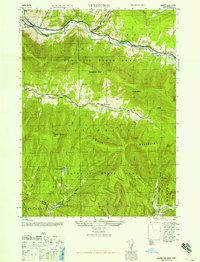
1946 Map of Lexington
USGS Topo · Published 1946About this map
The high peaks of Catskill State Park dominate this mid-century landscape, where the settlements of Lexington and Jewett Center sit along the narrow valley floors. The drainage patterns of Schoharie Creek and its tributaries, the East Kill and West Kill, dictated the placement of early mountain roads and homesteads. Local history is anchored at the Broadstreet Sch and family burial grounds like the Parker Cem and Maplewood Cem. High-elevation landmarks such as West Kill Mountain, Evergreen Mtn, and North Dome overlook steep hollows like Mink Hollow and Broadstreet Hollow. These deep ravines provided the only natural passages through the terrain, illustrated by the Van Winkle Trail winding along the northern slopes. Near the southern edge, the map records the community of Lanesville and the technical infrastructure of an Aqueduct, marking the intersection of wilderness and civil engineering.
Find a feature on this map
32 named features on this map. Tap any name to fly to it.
Don’t see what you’re looking for? This feature index may not catch every label — zoom into the map to look around manually.
Map Details
Editions of this 1946 Lexington Map
This is the sole edition of this map. No revisions or reprints were ever made.
Other maps of this area

1892 · Kaaterskill
USGS Topo · 1:62,500

1893 · Kaaterskill
USGS Topo · 1:62,500

1893 · Durham
USGS Topo · 1:62,500

1894 · Kaaterskill
USGS Topo · 1:62,500

1894 · Durham
USGS Topo · 1:62,500

1899 · Kaaterskill
USGS Topo · 1:62,500

1900 · Phoenicia
USGS Topo · 1:62,500

1901 · Gilboa
USGS Topo · 1:62,500

1903 · Gilboa
USGS Topo · 1:62,500

1903 · Phoenicia
USGS Topo · 1:62,500