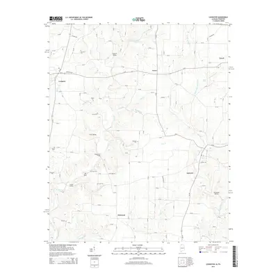
2014 Map of Lexington
USGS Topo · Published 2014About this map
The town of Lexington serves as the western anchor for this landscape where the Tennessee-Alabama border region transitions into a complex web of creek valleys and ridges. Local transit is defined by the intersection of Al-101 and Al-64, with the latter connecting the settlements of Grassy and Powell. The terrain is deeply incised by watercourses like Second Cr and Anderson Cr, creating numerous hollows such as Sawmill Hollow and Stout Hollow. For genealogists, the map is particularly dense with burial sites including Portertown Cem, Shelton Cem, and Harmon Cem, many situated near high points or along drainage divides. The central portion of the sheet features the Sledge Ford Bridge, a notable crossing over the winding Second Cr. Further south, the community of Whitehead sits near the confluence of Bills Br and Herston Br, illustrating how early 21st-century settlement patterns remained closely tied to the area's natural topography.
Find a feature on this map
123 named features on this map. Tap any name to fly to it.
Don’t see what you’re looking for? This feature index may not catch every label — zoom into the map to look around manually.
Map Details
Editions of this 2014 Lexington Map
This is the sole edition of this map. No revisions or reprints were ever made.
Other maps of this area

1914 · Rogersville
USGS Topo · 1:48,000

1916 · Rogersville
USGS Topo · 1:62,500

1936 · Union Hill
USGS Topo · 1:24,000

1936 · Thorntontown
USGS Topo · 1:24,000

1936 · Lexington
USGS Topo · 1:24,000

1936 · Loretto
USGS Topo · 1:24,000

1936 · Wheeler Dam
USGS Topo · 1:24,000
1936 · Center Hill
USGS Topo · 1:24,000

1936 · Appleton
USGS Topo · 1:24,000

1936 · Cairo
USGS Topo · 1:24,000