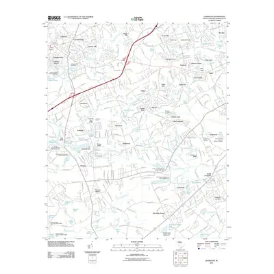
2011 Map of Lexington
USGS Topo · Published 2011About this map
Lexington and its surrounding suburbs are defined by a dense network of residential subdivisions and small impoundments in this early 21st-century record. The landscape is carved by the Twelvemile Creek and Red Bank Creek systems, which feed numerous named bodies of water such as the Saxe-Gotha Millpond, Lexington Mill Pond, and Sherman Pond. The era's suburban expansion is evident in the cluster of established communities like Three Fountains, Oakwood, and Red Bank, many of which developed around these historical water resources and mill sites.
Find a feature on this map
87 named features on this map. Tap any name to fly to it.
Don’t see what you’re looking for? This feature index may not catch every label — zoom into the map to look around manually.
Map Details
Editions of this 2011 Lexington Map
This is the sole edition of this map. No revisions or reprints were ever made.
Other maps of this area

1904 · Columbia
USGS Topo · 1:125,000

1941 · Spartanburg
USGS Topo · 1:250,000

1944 · Gilbert
USGS Topo · 1:62,500

1944 · Edmund
USGS Topo · 1:62,500

1946 · Irmo
USGS Topo · 1:24,000

1947 · Columbia North
USGS Topo · 1:24,000

1948 · Irmo
USGS Topo · 1:24,000

1948 · Columbia North
USGS Topo · 1:24,000

1953 · Spartanburg
USGS Topo · 1:250,000

1954 · Augusta
USGS Topo · 1:250,000