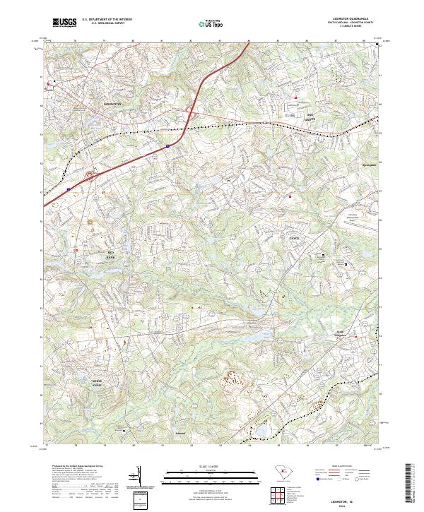
2024 Map of Lexington
USGS Topo · Published 2024About this map
The Lexington county seat serves as the anchor for this central South Carolina landscape, where the transition from residential development to agricultural and industrial corridors is clearly visible. The region is defined by a dense network of water bodies, including the Lexington Mill Pond and Gibsons Pond, which reflect the historic importance of local waterways for milling and industry. To the south, the terrain follows the winding course of Red Bank Creek and Congaree Creek, connecting the settlements of Red Bank and White Knoll.
Find a feature on this map
57 named features on this map. Tap any name to fly to it.
Don’t see what you’re looking for? This feature index may not catch every label — zoom into the map to look around manually.
Map Details
Editions of this 2024 Lexington Map
This is the sole edition of this map. No revisions or reprints were ever made.
Other maps of this area

1904 · Columbia
USGS Topo · 1:125,000

1941 · Spartanburg
USGS Topo · 1:250,000

1944 · Gilbert
USGS Topo · 1:62,500

1944 · Edmund
USGS Topo · 1:62,500

1946 · Irmo
USGS Topo · 1:24,000

1947 · Columbia North
USGS Topo · 1:24,000

1948 · Irmo
USGS Topo · 1:24,000

1948 · Columbia North
USGS Topo · 1:24,000

1953 · Spartanburg
USGS Topo · 1:250,000

1954 · Augusta
USGS Topo · 1:250,000