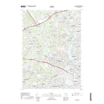
2018 Map of Lexington
USGS Topo · Published 2018About this map
Lexington and Arlington anchor this detailed study of the suburban landscape northwest of Boston, where dense residential networks meet significant glacial terrain features. The map illustrates the topographic prominence of heights such as Mt Gilboa, Wellington Hill, and Mt Ephraim, which separate the various drainage basins of Beaver Brook and the Mystic River. This era shows a fully developed commuter corridor, yet it preserves numerous historical sites including the Old Burying Ground in Winchester and the Prince Hall Mystic Cem in Medford. Cultural and educational landmarks like Bentley Univ and the Northeastern Univ Kostas Institute appear alongside established recreational waters like Horn Pond and Spy Pond. The presence of the B & M RR and numerous cemeteries, such as Munroe Cem and Saint Patricks Cem, provides a detailed geographic framework for local history and genealogical research.
Find a feature on this map
128 named features on this map. Tap any name to fly to it.
Don’t see what you’re looking for? This feature index may not catch every label — zoom into the map to look around manually.
Map Details
Editions of this 2018 Lexington Map
This is the sole edition of this map. No revisions or reprints were ever made.
Other maps of this area

1886 · Lawrence
USGS Topo · 1:62,500

1886 · Lowell
USGS Topo · 1:62,500

1886 · Framingham
USGS Topo · 1:62,500

1888 · Lawrence
USGS Topo · 1:62,500

1889 · Framingham
USGS Topo · 1:62,500

1893 · Lowell
USGS Topo · 1:62,500

1893 · Boston
USGS Topo · 1:62,500

1893 · Lawrence
USGS Topo · 1:62,500

1894 · Framingham
USGS Topo · 1:62,500

1903 · Boston
USGS Topo · 1:62,500