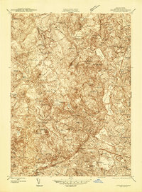
1944 Map of Lexington
USGS Topo · Published 1944About this map
Lexington and its surrounding Middlesex County townships appear in this 1943 survey as a landscape of established residential centers and significant institutional grounds just before the post-war suburban boom. The map detail highlights an era when large-scale facilities like the Metropolitan State Hospital, Middlesex County Sanatorium, and Fernald State Sch occupied substantial tracts of land between the historic village cores. In Cambridge, academic landmarks such as Radcliffe College and the Harvard Observatory are clearly delineated near Fresh Pond.
Find a feature on this map
107 named features on this map. Tap any name to fly to it.
Don’t see what you’re looking for? This feature index may not catch every label — zoom into the map to look around manually.
Map Details
Editions of this 1944 Lexington Map
This is the sole edition of this map. No revisions or reprints were ever made.
Other maps of this area

1886 · Lawrence
USGS Topo · 1:62,500

1886 · Lowell
USGS Topo · 1:62,500

1886 · Framingham
USGS Topo · 1:62,500

1888 · Lawrence
USGS Topo · 1:62,500

1889 · Framingham
USGS Topo · 1:62,500

1893 · Lowell
USGS Topo · 1:62,500

1893 · Boston
USGS Topo · 1:62,500

1893 · Lawrence
USGS Topo · 1:62,500

1894 · Framingham
USGS Topo · 1:62,500

1903 · Boston
USGS Topo · 1:62,500