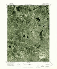
1977 Map of Lexington
USGS Topo · Published 1980About this map
Lexington and its surrounding suburban landscape are captured here in late 1970s orthophotography, providing a clear aerial record of the dense residential and commercial development within the Boston metropolitan periphery. The orthophotograph format allows for the direct observation of neighborhood layouts, major highway interchanges, and the remaining open spaces between established centers like Arlington, Waltham, and Belmont.
Find a feature on this map
13 named features on this map. Tap any name to fly to it.
Don’t see what you’re looking for? This feature index may not catch every label — zoom into the map to look around manually.
Map Details
Editions of this 1977 Lexington Map
This is the sole edition of this map. No revisions or reprints were ever made.
Other maps of this area

1886 · Lawrence
USGS Topo · 1:62,500

1886 · Lowell
USGS Topo · 1:62,500

1886 · Framingham
USGS Topo · 1:62,500

1888 · Lawrence
USGS Topo · 1:62,500

1889 · Framingham
USGS Topo · 1:62,500

1893 · Lowell
USGS Topo · 1:62,500

1893 · Boston
USGS Topo · 1:62,500

1893 · Lawrence
USGS Topo · 1:62,500

1894 · Framingham
USGS Topo · 1:62,500

1903 · Boston
USGS Topo · 1:62,500