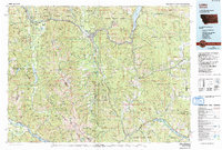
1978 Map of Libby
USGS Topo · Published 1993About this map
The Kootenai River and the vast timberlands of the Kootenai National Forest dominate this landscape, which transitioned through the 1970s and 1980s as the Koocanusa Lake reservoir took shape behind the Libby Dam. The town of Libby serves as the central hub, supported by the Burlington Northern railroad and industries connected to the surrounding Cabinet Mountains. High-altitude mining operations such as the Snowstorm Mine and Montana Morning Mine sit deep in the range, while smaller settlements like Troy and White Haven are clustered along the river corridors and US Highway 2. To the south, the timber and mining economy yields to the water-rich Thompson Lakes region and the high peaks of the Cabinet Mountains Wilderness, where names like Granite Peak and Sawtooth Mtn mark the high divide between the Kootenai and Clark Fork watersheds.
Find a feature on this map
120 named features on this map. Tap any name to fly to it.
Don’t see what you’re looking for? This feature index may not catch every label — zoom into the map to look around manually.
Map Details
Editions of this 1978 Libby Map
This is the sole edition of this map. No revisions or reprints were ever made.
Other maps of this area

1909 · Cataldo
USGS Topo · 1:125,000

1911 · Cataldo
USGS Topo · 1:125,000

1911 · Priest Lake
USGS Topo · 1:250,000

1913 · Priest Lake
USGS Topo · 1:250,000

1913 · Stryker
USGS Topo · 1:125,000

1916 · Stryker
USGS Topo · 1:125,000

1920 · Libby
USGS Topo · 1:125,000

1920 · Jennings
USGS Topo · 1:125,000

1930 · Libby
USGS Topo · 1:125,000
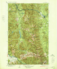
1932 · Libby
USGS Topo · 1:125,000