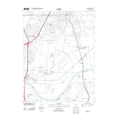
2012 Map of Liberty
USGS Topo · Published 2012About this map
The Missouri River winds along the southern edge of this Missouri landscape, shaping the industrial and residential development of Liberty and its surrounding communities. The river’s influence is evident in the prominent Liberty Bend and Big Blue Bend, as well as the specialized infrastructure of the Birmingham Levee Unit. North of the floodplain, the terrain is defined by the winding paths of Shoal Creek and Little Shoal Creek, which cut through established neighborhoods like Glenaire and Pleasant Valley.
Find a feature on this map
126 named features on this map. Tap any name to fly to it.
Don’t see what you’re looking for? This feature index may not catch every label — zoom into the map to look around manually.
Map Details
Editions of this 2012 Liberty Map
This is the sole edition of this map. No revisions or reprints were ever made.
Other maps of this area

1890 · Kansas City
USGS Topo · 1:125,000

1894 · Kansas City
USGS Topo · 1:125,000

1894 · Independence
USGS Topo · 1:125,000

1914 · Smithville
USGS Topo · 1:62,500

1933 · Blue Springs
USGS Topo · 1:24,000

1934 · Independence
USGS Topo · 1:24,000

1935 · Kansas City
USGS Topo · 1:24,000

1935 · Missouri City
USGS Topo · 1:24,000

1935 · North Kansas City
USGS Topo · 1:24,000

1935 · Liberty
USGS Topo · 1:24,000