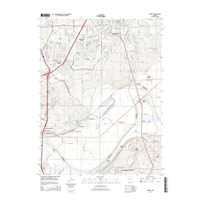
2015 Map of Liberty
USGS Topo · Published 2015About this map
Liberty and its surrounding Clay County landscapes are defined by the winding course of the Missouri River and a dense network of suburban and industrial development. This survey highlights the northern edge of the Kansas City metropolitan area, where the historic campus of William Jewell Coll overlooks the city center. The map documents several established burial grounds including Fairview Cemetery and New Hope Cemetery, alongside smaller family plots like Davidson Cemetery. To the south, the river plains show a transition from heavy industrial zones like Cement City and Sugar Creek to major recreational landmarks such as Worlds of Fun. The complex transportation infrastructure is anchored by the Missouri Pacific RR and significant river crossings, including the Independence-Liberty Bridge and the Harry S Truman Bridge, which link the various communities across the county line.
Find a feature on this map
101 named features on this map. Tap any name to fly to it.
Don’t see what you’re looking for? This feature index may not catch every label — zoom into the map to look around manually.
Map Details
Editions of this 2015 Liberty Map
This is the sole edition of this map. No revisions or reprints were ever made.
Other maps of this area

1890 · Kansas City
USGS Topo · 1:125,000

1894 · Kansas City
USGS Topo · 1:125,000

1894 · Independence
USGS Topo · 1:125,000

1914 · Smithville
USGS Topo · 1:62,500

1933 · Blue Springs
USGS Topo · 1:24,000

1934 · Independence
USGS Topo · 1:24,000

1935 · Kansas City
USGS Topo · 1:24,000

1935 · Missouri City
USGS Topo · 1:24,000

1935 · North Kansas City
USGS Topo · 1:24,000

1935 · Liberty
USGS Topo · 1:24,000