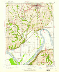
1935 Map of Liberty
USGS Topo · Published 1960About this map
William Jewell College anchors the topography of this mid-1930s Clay County landscape, overlooking the city of Liberty and its surrounding agricultural reaches. The terrain is marked by a complex network of schools and charitable institutions, such as Brick Monroe Sch and the Odd Fellows Home, alongside the Helping Hand Farm. Along the banks of the Missouri River, the industrial and social character of the era is evident at the Federal Transient Camp and the small settlements of Birmingham and Cement City. A heavy concentration of rail lines, including the Chicago Milwaukee St Paul and Pacific and the Wabash, converge near the river, illustrating the region's importance as a transportation corridor connecting local mills and pumping stations to the broader Missouri economy.
Find a feature on this map
48 named features on this map. Tap any name to fly to it.
Don’t see what you’re looking for? This feature index may not catch every label — zoom into the map to look around manually.
Map Details
Editions of this 1935 Liberty Map
2 editions found
Other maps of this area

1890 · Kansas City
USGS Topo · 1:125,000

1894 · Kansas City
USGS Topo · 1:125,000

1894 · Independence
USGS Topo · 1:125,000

1914 · Smithville
USGS Topo · 1:62,500

1933 · Blue Springs
USGS Topo · 1:24,000

1934 · Independence
USGS Topo · 1:24,000

1935 · Kansas City
USGS Topo · 1:24,000

1935 · Missouri City
USGS Topo · 1:24,000

1935 · North Kansas City
USGS Topo · 1:24,000

1935 · Liberty
USGS Topo · 1:24,000