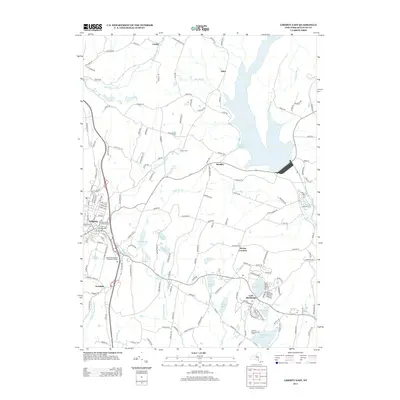
2013 Map of Liberty East
USGS Topo · Published 2013About this map
Loch Sheldrake and the village of Liberty anchor this Sullivan County landscape during a period of established residential and recreational development. The eastern portion of the sheet is dominated by the Neversink River and its accompanying reservoir waters, including Theodore Gordon Cove. This era reflects a transition in the Catskills region, where historic agricultural sites like Fisher Farm exist alongside modern infrastructure such as the Liberty Wastewater Treatment Facility and the Lochmor Municipal Golf Course.
Find a feature on this map
166 named features on this map. Tap any name to fly to it.
Don’t see what you’re looking for? This feature index may not catch every label — zoom into the map to look around manually.
Map Details
Editions of this 2013 Liberty East Map
This is the sole edition of this map. No revisions or reprints were ever made.
Other maps of this area

1909 · Monticello
USGS Topo · 1:62,500

1910 · Neversink
USGS Topo · 1:62,500

1911 · Monticello
USGS Topo · 1:62,500

1921 · Livingston Manor
USGS Topo · 1:62,500

1922 · White Lake
USGS Topo · 1:62,500

1923 · Livingston Manor
USGS Topo · 1:62,500

1942 · White Lake
USGS Topo · 1:62,500

1942 · Neversink
USGS Topo · 1:62,500

1943 · White Lake
USGS Topo · 1:62,500

1943 · Monticello
USGS Topo · 1:62,500