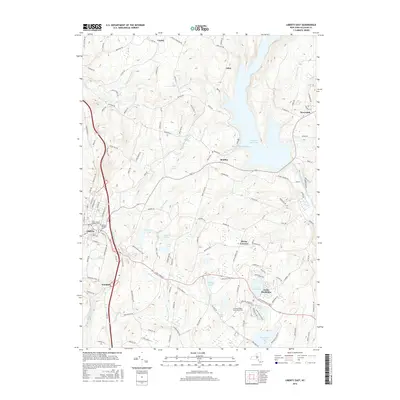
2016 Map of Liberty East
USGS Topo · Published 2016About this map
Neversink Reservoir dominates the eastern terrain of this Sullivan County landscape, its waters reaching into Theodore Gordon Cove and drawing from the Neversink River. The area is defined by a dense network of mountain roads and small water bodies that supported the region's long history as a summer retreat. To the west, the village of Liberty sits near the Liberty Soldiers Cem and Saint Peter's Catholic Cem, marking the eastern edge of the settlement. The map captures the specialized land use of the mid-Sullivan region, from the educational campus of Sullivan County Community Coll near Loch Sheldrake to the legacy of leisure at Grossingers Lake. This 2016 survey reflects a modern topography still anchored by older hamlets like Divine Corners, Ferndale, and Cooley, connected by an intricate web of local routes including Aden Hill Rd and Cooley Mountain Rd.
Find a feature on this map
135 named features on this map. Tap any name to fly to it.
Don’t see what you’re looking for? This feature index may not catch every label — zoom into the map to look around manually.
Map Details
Editions of this 2016 Liberty East Map
This is the sole edition of this map. No revisions or reprints were ever made.
Other maps of this area

1909 · Monticello
USGS Topo · 1:62,500

1910 · Neversink
USGS Topo · 1:62,500

1911 · Monticello
USGS Topo · 1:62,500

1921 · Livingston Manor
USGS Topo · 1:62,500

1922 · White Lake
USGS Topo · 1:62,500

1923 · Livingston Manor
USGS Topo · 1:62,500

1942 · White Lake
USGS Topo · 1:62,500

1942 · Neversink
USGS Topo · 1:62,500

1943 · White Lake
USGS Topo · 1:62,500

1943 · Monticello
USGS Topo · 1:62,500