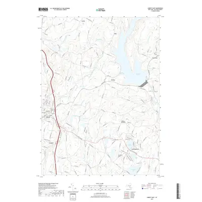
2019 Map of Liberty East
USGS Topo · Published 2019About this map
Liberty and its surrounding hamlets define this Sullivan County landscape, where the Middle Mongaup River and E Mongaup River carve through the terrain. The area is marked by a high density of water features, from the expansive Neversink Reservoir and its Theodore Gordon Cove to smaller basins like Grossingers Lake, Lake Ophelia, and Sunset Lake. This network of waterways historically supported the regional tourism and recreation industry that shaped local development.
Find a feature on this map
143 named features on this map. Tap any name to fly to it.
Don’t see what you’re looking for? This feature index may not catch every label — zoom into the map to look around manually.
Map Details
Editions of this 2019 Liberty East Map
This is the sole edition of this map. No revisions or reprints were ever made.
Other maps of this area

1909 · Monticello
USGS Topo · 1:62,500

1910 · Neversink
USGS Topo · 1:62,500

1911 · Monticello
USGS Topo · 1:62,500

1921 · Livingston Manor
USGS Topo · 1:62,500

1922 · White Lake
USGS Topo · 1:62,500

1923 · Livingston Manor
USGS Topo · 1:62,500

1942 · White Lake
USGS Topo · 1:62,500

1942 · Neversink
USGS Topo · 1:62,500

1943 · White Lake
USGS Topo · 1:62,500

1943 · Monticello
USGS Topo · 1:62,500