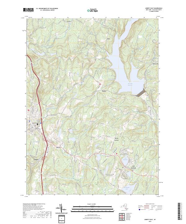
2023 Map of Liberty East
USGS Topo · Published 2023About this map
The Catskill mountain landscape around Liberty is defined by its transition from historic village centers to the expansive waters of the Neversink Reservoir. This survey captures the area's mid-century evolution into a center for education and recreation, anchored by the SUNY Sullivan County Community College campus and the sprawling Grossinger Golf Crse near Grossingers Lake. The village of Liberty remains a focal point, featuring the Liberty Cem, Saint Peter's Catholic Cem, and a dedicated Veterans Section.
Find a feature on this map
147 named features on this map. Tap any name to fly to it.
Don’t see what you’re looking for? This feature index may not catch every label — zoom into the map to look around manually.
Map Details
Editions of this 2023 Liberty East Map
This is the sole edition of this map. No revisions or reprints were ever made.
Other maps of this area

1909 · Monticello
USGS Topo · 1:62,500

1910 · Neversink
USGS Topo · 1:62,500

1911 · Monticello
USGS Topo · 1:62,500

1921 · Livingston Manor
USGS Topo · 1:62,500

1922 · White Lake
USGS Topo · 1:62,500

1923 · Livingston Manor
USGS Topo · 1:62,500

1942 · White Lake
USGS Topo · 1:62,500

1942 · Neversink
USGS Topo · 1:62,500

1943 · White Lake
USGS Topo · 1:62,500

1943 · Monticello
USGS Topo · 1:62,500