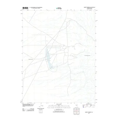
2012 Map of Liberty Springs
USGS Topo · Published 2012About this map
Big Smoky Valley dominates the western portion of this 2012 survey, illustrating the characteristic desert basin and range geography of central Nevada. The arid landscape is defined by the contrast between the broad valley floor and the rising slopes of the San Antonio Mountains to the east. A notable hydrological feature in this dry environment is Liberty Springs, which serves as a critical point of interest for understanding the distribution of water resources in Nye County. The network of roads and tracks shown indicates the ongoing use of the area for transit and land management, while the absence of dense development highlights the expansive, open character typical of this part of the state.
Find a feature on this map
3 named features on this map. Tap any name to fly to it.
Don’t see what you’re looking for? This feature index may not catch every label — zoom into the map to look around manually.
Map Details
Editions of this 2012 Liberty Springs Map
This is the sole edition of this map. No revisions or reprints were ever made.
Other maps of this area

1907 · Tonopah
USGS Topo · 1:250,000

1908 · Tonopah
USGS Topo · 1:250,000

1956 · Tonopah
USGS Topo · 1:250,000

1959 · Tonopah
USGS Topo · 1:250,000

1961 · Tonopah
USGS Topo · 1:62,500

1961 · Lone Mtn
USGS Topo · 1:62,500

1962 · Tonopah
USGS Topo · 1:250,000

1963 · Baxter Spring
USGS Topo · 1:62,500

1964 · San Antonio Ranch
USGS Topo · 1:62,500
1987 · Rays
USGS Topo · 1:24,000