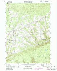
1969 Map of Liberty
USGS Topo · Published 1986About this map
The borough of Liberty sits at the intersection of mountain valleys in Tioga County, serving as a hub for the surrounding upland farms and forests during the late 1960s. This survey, updated with 1980s aerial data, reveals a landscape defined by sharp elevation changes between Brier Mountain and the watercourses of Blacks Creek and Roaring Branch. Local education and community life are anchored at the Joint High School and nearby houses of worship, including Union Church and Friedens Church.
Find a feature on this map
29 named features on this map. Tap any name to fly to it.
Don’t see what you’re looking for? This feature index may not catch every label — zoom into the map to look around manually.
Map Details
Editions of this 1969 Liberty Map
Other maps of this area

1921 · Trout Run
USGS Topo · 1:62,500

1923 · Trout Run
USGS Topo · 1:62,500

1925 · Blossburg
USGS Topo · 1:62,500

1927 · Blossburg
USGS Topo · 1:62,500

1930 · Warrensville
USGS Topo · 1:62,500

1934 · Warrensville
USGS Topo · 1:62,500

1942 · Canton
USGS Topo · 1:62,500

1944 · Blossburg
USGS Topo · 1:62,500

1944 · Trout Run
USGS Topo · 1:62,500

1944 · Canton
USGS Topo · 1:62,500
Featured Places
- Liberty, PA
- Veilstown, Liberty Township
- Union Township, PA
- House Landing Strip, Liberty Township
- Jackson Township, PA