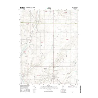
2016 Map of Liberty
USGS Topo · Published 2016About this map
Liberty serves as the focal point of this Union County landscape, situated at the intersection of several regional thoroughfares including S Main St and Huntington Rd. The settlement pattern reflects the agricultural and burial traditions of the region, evidenced by the numerous cemeteries distributed across the countryside, such as West Point Cem and Silver Creek Cem. The East Fork Whitewater River carves a path through the western portion of the terrain, joined by tributaries like Clifton Cr and Richland Cr. Smaller communities like Abington and Clifton are connected by a network of rural routes, including N Patterson Rd and W Old Brownsville Rd. This survey highlights the distribution of family-named landmarks and local burial grounds like Locust Grove Cem and Drook Cem that anchor the local genealogy of the area.
Find a feature on this map
88 named features on this map. Tap any name to fly to it.
Don’t see what you’re looking for? This feature index may not catch every label — zoom into the map to look around manually.
Map Details
Editions of this 2016 Liberty Map
This is the sole edition of this map. No revisions or reprints were ever made.
Other maps of this area

1915 · New Paris
USGS Topo · 1:48,000

1915 · College Corner
USGS Topo · 1:48,000

1918 · College Corner
USGS Topo · 1:62,500

1918 · New Paris
USGS Topo · 1:62,500

1948 · Fairfield
USGS Topo · 1:24,000

1953 · Cincinnati
USGS Topo · 1:250,000

1956 · Everton
USGS Topo · 1:24,000

1956 · Brownsville
USGS Topo · 1:24,000

1957 · Cincinnati
USGS Topo · 1:250,000

1960 · Liberty
USGS Topo · 1:24,000