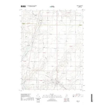
2019 Map of Liberty
USGS Topo · Published 2019About this map
Liberty serves as the prominent seat of this rural landscape, situated at the southern end of a territory defined by the meandering East Fork Whitewater River. The settlement pattern follows the river valley and its numerous tributaries, including Richland Cr and Silver Cr, which carve through the farmland. Local history is deeply etched into the countryside through a high density of rural burial grounds such as Silver Creek Cem, Locust Grove Methodist Episcopal Cem, and Woods Chapel Cem, marking the locations of early community centers and pioneer family plots. Small crossroads hamlets like Abington, Clifton, and the curiously named Yankee Town anchor the various townships. The landscape is primarily agricultural, crisscrossed by a grid of county roads and distinctive landmarks like the Bridle Trail A, reflecting a community tied to the land and its natural watercourses.
Find a feature on this map
102 named features on this map. Tap any name to fly to it.
Don’t see what you’re looking for? This feature index may not catch every label — zoom into the map to look around manually.
Map Details
Editions of this 2019 Liberty Map
This is the sole edition of this map. No revisions or reprints were ever made.
Other maps of this area

1915 · New Paris
USGS Topo · 1:48,000

1915 · College Corner
USGS Topo · 1:48,000

1918 · College Corner
USGS Topo · 1:62,500

1918 · New Paris
USGS Topo · 1:62,500

1948 · Fairfield
USGS Topo · 1:24,000

1953 · Cincinnati
USGS Topo · 1:250,000

1956 · Everton
USGS Topo · 1:24,000

1956 · Brownsville
USGS Topo · 1:24,000

1957 · Cincinnati
USGS Topo · 1:250,000

1960 · Liberty
USGS Topo · 1:24,000