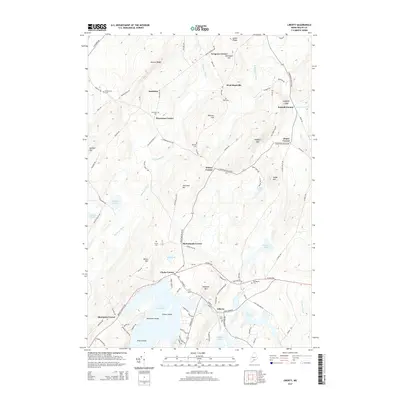
2014 Map of Liberty
USGS Topo · Published 2014About this map
Saint George Lake anchors the southern landscape of this mid-coast Maine region, where the Saint George River begins its course eastward. The village of Liberty sits at the lake's outlet, serving as a historic nexus for local travel along the Acadia Hwy. To the north, the terrain transitions into a network of upland ridges like Beaver Ridge and Goose Ridge, drained by the south-flowing Sheepscot River. The map reveals a distinct pattern of small, localized crossroads settlements, often named for founding families, including McFarlands Corner, Whites Corner, and Thurstons Corner. These intersections, along with numerous family cemeteries such as Bradstreet Cem and Vose Cem, provide a clear spatial record of the area's agricultural and rural heritage.
Find a feature on this map
107 named features on this map. Tap any name to fly to it.
Don’t see what you’re looking for? This feature index may not catch every label — zoom into the map to look around manually.
Map Details
Editions of this 2014 Liberty Map
This is the sole edition of this map. No revisions or reprints were ever made.
Other maps of this area

1915 · Belfast
USGS Topo · 1:62,500

1916 · Liberty
USGS Topo · 1:62,500

1917 · Belfast
USGS Topo · 1:62,500

1926 · Burnham
USGS Topo · 1:62,500

1932 · Brooks
USGS Topo · 1:62,500

1941 · Belfast
USGS Topo · 1:62,500

1942 · Liberty
USGS Topo · 1:62,500

1948 · Bangor
USGS Topo · 1:250,000

1950 · Belfast
USGS Topo · 1:50,000

1950 · Liberty
USGS Topo · 1:50,000