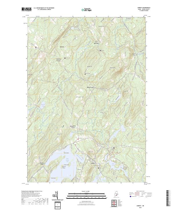
2024 Map of Liberty
USGS Topo · Published 2024About this map
Saint George Lake serves as a central landmark in this Waldo County landscape, where the Saint George River flows through the village of Liberty. The settlement pattern is defined by several historic road junctions, including Thurstons Corner, Whites Corner, and McFarlands Corner, which reveal the distributed nature of early Maine homesteading. Notable for genealogists are several family-named burial grounds like Vose Cem, Bradstreet Cem, and Whitten Cem, often situated near the prominent hills that overlook the river valleys. The terrain transitions from the marshy edges of Mud Pond and Chisholm Pond to the elevated ridges of Beaver Ridge and Hogback Mtn. This modern survey documents the contemporary road network, including the Belfast Augusta Rd, while preserving the locations of long-standing community landmarks like the Mount Repose Cem.
Find a feature on this map
107 named features on this map. Tap any name to fly to it.
Don’t see what you’re looking for? This feature index may not catch every label — zoom into the map to look around manually.
Map Details
Editions of this 2024 Liberty Map
This is the sole edition of this map. No revisions or reprints were ever made.
Other maps of this area

1915 · Belfast
USGS Topo · 1:62,500

1916 · Liberty
USGS Topo · 1:62,500

1917 · Belfast
USGS Topo · 1:62,500

1926 · Burnham
USGS Topo · 1:62,500

1932 · Brooks
USGS Topo · 1:62,500

1941 · Belfast
USGS Topo · 1:62,500

1942 · Liberty
USGS Topo · 1:62,500

1948 · Bangor
USGS Topo · 1:250,000

1950 · Belfast
USGS Topo · 1:50,000

1950 · Liberty
USGS Topo · 1:50,000