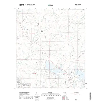
2018 Map of Liberty
USGS Topo · Published 2018About this map
Liberty and Cluster Springs anchor this portion of Walton County, where the landscape is defined by an intricate network of wetlands, creeks, and small lakes. In the southern reaches of the map, the northern edge of De Funiak Springs begins to appear with a dense grid of residential streets like Orange Blossom Ave and Larkspur Ave. The hydrology of the region is notably diverse, featuring the winding Gum Cr and Shoal River systems alongside unique water bodies like Duck Puddle and Pretty Pond. Near the eastern border, the community of Piney Grove sits north of Juniper Lake, while the northern terrain transitions into broader drainage areas such as Cypress Drains and Cow Bay. This 2018 survey reveals the persistent rural character of the Florida Panhandle, where large swampy tracts like Big Swamp Cr remain largely undeveloped, punctuated only by a few long-standing rural roads and scattered family-named ponds.
Find a feature on this map
127 named features on this map. Tap any name to fly to it.
Don’t see what you’re looking for? This feature index may not catch every label — zoom into the map to look around manually.
Map Details
Editions of this 2018 Liberty Map
This is the sole edition of this map. No revisions or reprints were ever made.
Other maps of this area

1934 · Niceville
USGS Topo · 1:48,000

1935 · De Funiak Springs
USGS Topo · 1:48,000

1936 · Niceville
USGS Topo · 1:62,500

1938 · De Funiak Springs
USGS Topo · 1:62,500

1949 · Glendale
USGS Topo · 1:62,500

1949 · Laurel Hill
USGS Topo · 1:62,500

1950 · Laurel Hill
USGS Topo · 1:62,500

1951 · Glendale
USGS Topo · 1:62,500

1956 · Niceville
USGS Topo · 1:62,500

1957 · Pensacola
USGS Topo · 1:250,000