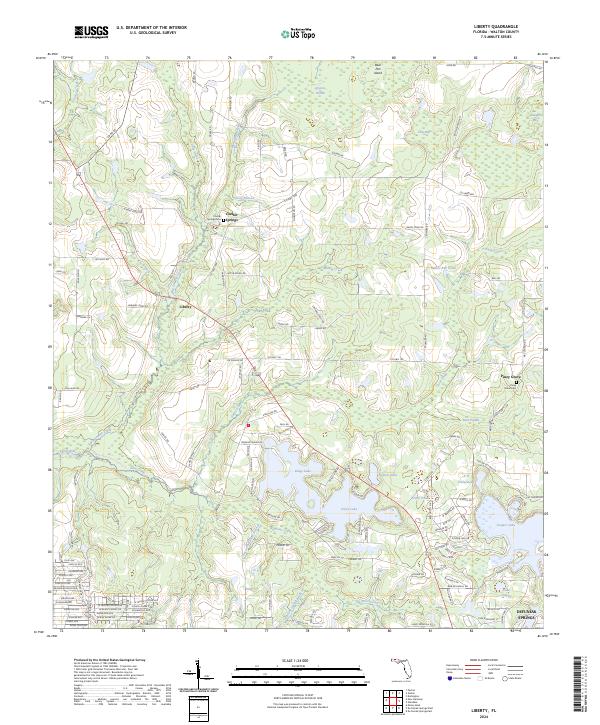
2024 Map of Liberty
USGS Topo · Published 2024About this map
Kings Lake and Juniper Lake anchor the southern landscape of this Walton County region, where the terrain is defined by a dense network of tributaries and lowland basins. The northern sections transition into distinctive terrain features like Bear Pen Island and Cow Bay, while the Shoal River State Paddling Trail follows the course of the Shoal River in the west. Small settlements and local landmarks are scattered across the quadrangle, including the community of Liberty and the cemetery at Cluster Springs Cem.
Find a feature on this map
147 named features on this map. Tap any name to fly to it.
Don’t see what you’re looking for? This feature index may not catch every label — zoom into the map to look around manually.
Map Details
Editions of this 2024 Liberty Map
This is the sole edition of this map. No revisions or reprints were ever made.
Other maps of this area

1934 · Niceville
USGS Topo · 1:48,000

1935 · De Funiak Springs
USGS Topo · 1:48,000

1936 · Niceville
USGS Topo · 1:62,500

1938 · De Funiak Springs
USGS Topo · 1:62,500

1949 · Glendale
USGS Topo · 1:62,500

1949 · Laurel Hill
USGS Topo · 1:62,500

1950 · Laurel Hill
USGS Topo · 1:62,500

1951 · Glendale
USGS Topo · 1:62,500

1956 · Niceville
USGS Topo · 1:62,500

1957 · Pensacola
USGS Topo · 1:250,000