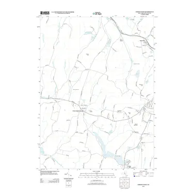
2013 Map of Liberty West
USGS Topo · Published 2013About this map
Parksville and White Sulphur Springs anchor this portion of Sullivan County, where the Catskill foothills transition into a landscape defined by small water bodies and historical farming tracts. The area is dense with genealogical markers, including the Old Baptist Church Cem and Martin Cem near the northern settlements, and Laurel Hill Cem further south. The map documents a blend of recreation and local industry, from Camp Olympus and Blueberry Hill Camp to the Walnut Mountain Farm and Nursery. Numerous small waterways such as Little Beaver Kill and Shingle Brook drain the terrain between high points like Revonah Hill and Chuck Hill. The settlement pattern follows older road networks like Dahlia Rd and Parksville Rd, connecting established hamlets like Loomis and Benton Hollow to the larger waters of Swan Lake at the southern edge.
Find a feature on this map
128 named features on this map. Tap any name to fly to it.
Don’t see what you’re looking for? This feature index may not catch every label — zoom into the map to look around manually.
Map Details
Editions of this 2013 Liberty West Map
This is the sole edition of this map. No revisions or reprints were ever made.
Other maps of this area

1909 · Monticello
USGS Topo · 1:62,500

1910 · Neversink
USGS Topo · 1:62,500

1911 · Monticello
USGS Topo · 1:62,500

1921 · Livingston Manor
USGS Topo · 1:62,500

1922 · White Lake
USGS Topo · 1:62,500

1923 · Livingston Manor
USGS Topo · 1:62,500

1942 · White Lake
USGS Topo · 1:62,500

1942 · Neversink
USGS Topo · 1:62,500

1943 · White Lake
USGS Topo · 1:62,500

1943 · Monticello
USGS Topo · 1:62,500