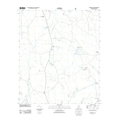
2011 Map of Libertyville
USGS Topo · Published 2011About this map
Libertyville and the surrounding rural communities of Stanley and Red Oak define the landscape of central Covington County in this early 21st-century study. The terrain is characterized by a dense network of water bodies and minor tributaries feeding into the Yellow River, which meanders through the southeastern quadrant. Local family and place names are prominent across the landscape, seen in landmarks such as the Yellow River Lookout Tower and crossings like Cravey Bridge.
Find a feature on this map
44 named features on this map. Tap any name to fly to it.
Don’t see what you’re looking for? This feature index may not catch every label — zoom into the map to look around manually.
Map Details
Editions of this 2011 Libertyville Map
This is the sole edition of this map. No revisions or reprints were ever made.
Other maps of this area

1953 · Andalusia
USGS Topo · 1:250,000

1957 · Andalusia
USGS Topo · 1:250,000

1971 · Carolina
USGS Topo · 1:24,000

1971 · Libertyville
USGS Topo · 1:24,000

1971 · Onycha
USGS Topo · 1:24,000

1971 · Wing
USGS Topo · 1:24,000

1971 · River Falls
USGS Topo · 1:24,000

1971 · Andalusia
USGS Topo · 1:24,000
1971 · Florala
USGS Topo · 1:24,000
1971 · Watkins Bridge
USGS Topo · 1:24,000