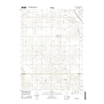
2015 Map of Libertyville
USGS Topo · Published 2015About this map
Libertyville sits at a crossroads of the Jefferson County prairie, serving as the primary hub for a landscape defined by traditional agricultural section lines and an intricate drainage network. The area north of the settlement is shaped by the winding course of Cedar Creek and Grubb Run, while the southern terrain breaks into more complex topography around Spahn Hollow and the various branches of Lick Cr. This survey is particularly useful for genealogical research, as it documents several family and community burial sites dispersed across the townships, including Smith Cem, Fell Cem, and the Brethren Cem near the western boundary. The map captures the interface between the southern edge of Jefferson County and the northern border of Van Buren County, showing how local transit routes like Co HWY v64 and Co HWY j12 link these rural Iowa communities.
Find a feature on this map
75 named features on this map. Tap any name to fly to it.
Don’t see what you’re looking for? This feature index may not catch every label — zoom into the map to look around manually.
Map Details
Editions of this 2015 Libertyville Map
This is the sole edition of this map. No revisions or reprints were ever made.
Other maps of this area

1954 · Centerville
USGS Topo · 1:250,000

1954 · Des Moines
USGS Topo · 1:250,000

1956 · Des Moines
USGS Topo · 1:250,000

1957 · Des Moines
USGS Topo · 1:250,000

1957 · Centerville
USGS Topo · 1:250,000

1958 · Centerville
USGS Topo · 1:250,000

1958 · Burlington
USGS Topo · 1:250,000

1958 · Davenport
USGS Topo · 1:250,000

1961 · Burlington
USGS Topo · 1:250,000

1961 · Davenport
USGS Topo · 1:250,000