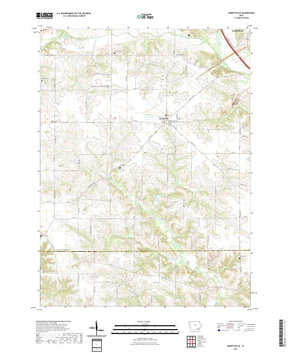
2022 Map of Libertyville
USGS Topo · Published 2022About this map
Libertyville sits at the heart of this Jefferson County landscape, serving as a central hub for a network of rural roads including Libertyville Rd and Co Hwy V64. The area is defined by its agricultural character and a surprisingly high density of small family or community burial grounds, such as Smith Cem, McCleary Cem, and Brethren Cem. The terrain is etched by a complex drainage system featuring Lick Cr and its various branches, which transition into the southern reaches of Spahn Hollow. Toward the northeast corner, the edge of Fairfield appears, connected to the surrounding countryside by the Fairfield Trail Loop Trl and Cedar View Trl. This modern survey documents the persistent rural footprint of the region, where township lines like t71n r10w still dictate the orderly grid of section roads and farmsteads.
Find a feature on this map
79 named features on this map. Tap any name to fly to it.
Don’t see what you’re looking for? This feature index may not catch every label — zoom into the map to look around manually.
Map Details
Editions of this 2022 Libertyville Map
This is the sole edition of this map. No revisions or reprints were ever made.
Other maps of this area

1954 · Centerville
USGS Topo · 1:250,000

1954 · Des Moines
USGS Topo · 1:250,000

1956 · Des Moines
USGS Topo · 1:250,000

1957 · Des Moines
USGS Topo · 1:250,000

1957 · Centerville
USGS Topo · 1:250,000

1958 · Centerville
USGS Topo · 1:250,000

1958 · Burlington
USGS Topo · 1:250,000

1958 · Davenport
USGS Topo · 1:250,000

1961 · Burlington
USGS Topo · 1:250,000

1961 · Davenport
USGS Topo · 1:250,000