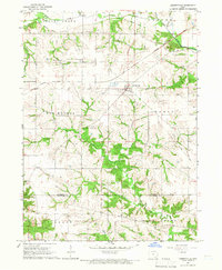
1965 Map of Libertyville
USGS Topo · Published 1966About this map
Libertyville serves as the central hub for this mid-1960s agricultural landscape, where the Chicago Rock Island and Pacific railroad bisects the terrain. The map captures a transition in local infrastructure, noting an Old Railroad Grade that suggests earlier transport routes since bypassed. The southern portion of the sheet is defined by the intricate drainage of the East Branch Lick Creek and Lick Creek, which carve deep patterns into the topography near the Jefferson Co Van Buren Co line.
Find a feature on this map
29 named features on this map. Tap any name to fly to it.
Don’t see what you’re looking for? This feature index may not catch every label — zoom into the map to look around manually.
Map Details
Editions of this 1965 Libertyville Map
This is the sole edition of this map. No revisions or reprints were ever made.
Other maps of this area

1954 · Centerville
USGS Topo · 1:250,000

1954 · Des Moines
USGS Topo · 1:250,000

1956 · Des Moines
USGS Topo · 1:250,000

1957 · Des Moines
USGS Topo · 1:250,000

1957 · Centerville
USGS Topo · 1:250,000

1958 · Centerville
USGS Topo · 1:250,000

1958 · Burlington
USGS Topo · 1:250,000

1958 · Davenport
USGS Topo · 1:250,000

1961 · Burlington
USGS Topo · 1:250,000

1961 · Davenport
USGS Topo · 1:250,000