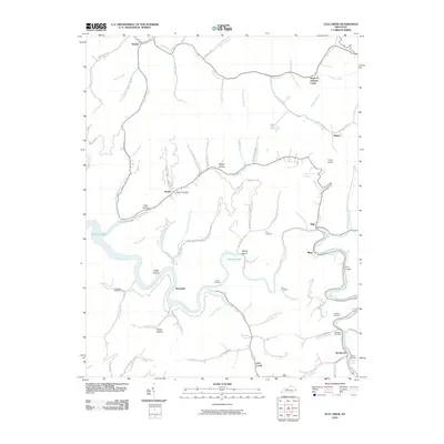
2010 Map of Lick Creek
USGS Topo · Published 2010About this map
Levisa Fork and Johns Creek wind through the hills of eastern Kentucky, defining a landscape shaped by narrow hollows and river bends. The waters of Fishtrap Lake occupy the central valley, surrounding Stump Island and bordering communities such as Woodside and Biggs. This 2010 survey captures the residential patterns of Pike County, where settlements like Phyllis, Nigh, and Mouthcard follow the level ground along the river and its numerous tributaries, including Grapevine Creek and Millers Creek.
Find a feature on this map
78 named features on this map. Tap any name to fly to it.
Don’t see what you’re looking for? This feature index may not catch every label — zoom into the map to look around manually.
Map Details
Editions of this 2010 Lick Creek Map
This is the sole edition of this map. No revisions or reprints were ever made.
Other maps of this area

1886 · Grundy
USGS Topo · 1:125,000

1887 · Warfield
USGS Topo · 1:125,000

1890 · Grundy
USGS Topo · 1:125,000

1891 · Warfield
USGS Topo · 1:125,000

1892 · Grundy
USGS Topo · 1:125,000

1909 · Matewan
USGS Topo · 1:48,000

1914 · Hurley
USGS Topo · 1:48,000

1915 · Regina
USGS Topo · 1:48,000

1915 · Hurley
USGS Topo · 1:48,000

1915 · Williamson
USGS Topo · 1:48,000