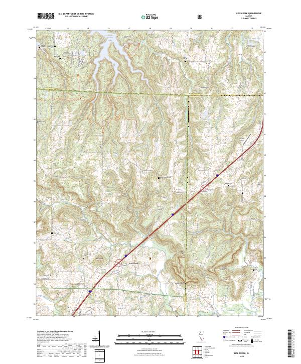
2024 Map of Lick Creek
USGS Topo · Published 2024About this map
Shawnee National Forest and the southern reaches of Devils Kitchen Lake define this corner of Southern Illinois, where the boundaries of Williamson, Union, and Johnson counties meet. The landscape is characterized by prominent high points and rocky outcroppings like Drapers Bluff, Cedar Bluff, and Buck Knob, which tower over the surrounding woodlands. The settlement of Lick Creek sits at a crossroads in the southwestern quadrant, serving as a focal point for a region marked by numerous small family and community burial grounds, including Old Pleasant Hill Cem, Ebenezer-Hall Cem, and Toler Cem. These cemeteries, often tucked away near forest edges or old farm roads like Rocky Comfort Rd, provide significant data for genealogical research. The northern portion of the map is largely dedicated to the Crab Orchard National Wildlife Refuge and the Panther-Den Wilderness, preserving the primitive character of the Panther Den area.
Find a feature on this map
82 named features on this map. Tap any name to fly to it.
Don’t see what you’re looking for? This feature index may not catch every label — zoom into the map to look around manually.
Map Details
Editions of this 2024 Lick Creek Map
This is the sole edition of this map. No revisions or reprints were ever made.
Other maps of this area

1918 · Vienna
USGS Topo · 1:62,500

1919 · Vienna
USGS Topo · 1:62,500

1920 · Dongola
USGS Topo · 1:62,500

1922 · Carbondale
USGS Topo · 1:62,500

1923 · Dongola
USGS Topo · 1:62,500

1925 · Marion
USGS Topo · 1:62,500

1940 · Marion
USGS Topo · 1:62,500

1941 · Carbondale
USGS Topo · 1:62,500

1942 · Vienna
USGS Topo · 1:62,500

1949 · Paducah
USGS Topo · 1:250,000