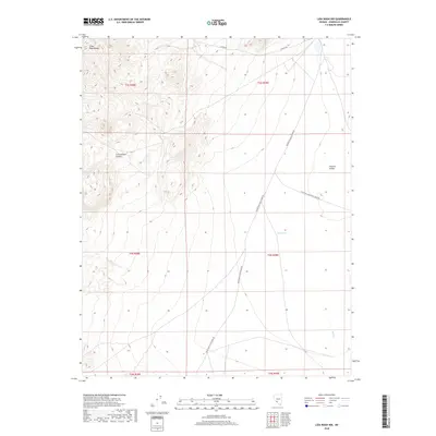
2018 Map of Lida Wash NW
USGS Topo · Published 2018About this map
Silver Peak Range dominates the western half of this Esmeralda County landscape, dropping sharply into the broad basin of the Clayton Valley. The topographic relief is defined by the steep drainage of Cottonwood Canyon, while the valley floor below features the isolated Soda Spring. These geographic markers provide essential context for the high-desert hydrology of the region, where seasonal water sources like Birch Cr are critical landmarks. Remote transit corridors including Silver Peak Oasis Divide Rd and Coyote Rd traverse the alluvial fans, showing the sparse but necessary road network connecting the mountain passes to the valley basin. The map illustrates the classic Great Basin transition from high alpine ridges to the expansive, arid flats that define this part of the Nevada interior.
Find a feature on this map
14 named features on this map. Tap any name to fly to it.
Don’t see what you’re looking for? This feature index may not catch every label — zoom into the map to look around manually.
Map Details
Editions of this 2018 Lida Wash NW Map
This is the sole edition of this map. No revisions or reprints were ever made.
Other maps of this area

1898 · Silver Peak
USGS Topo · 1:125,000

1900 · Silver Peak
USGS Topo · 1:125,000

1908 · Lida
USGS Topo · 1:250,000

1913 · Lida
USGS Topo · 1:250,000

1954 · Goldfield
USGS Topo · 1:250,000

1955 · Goldfield
USGS Topo · 1:250,000

1958 · Goldfield
USGS Topo · 1:250,000

1962 · Goldfield
USGS Topo · 1:250,000
1963 · Piper Peak
USGS Topo · 1:62,500

1963 · Silver Peak
USGS Topo · 1:62,500