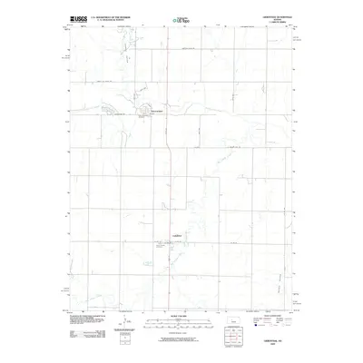
2009 Map of Liebenthal
USGS Topo · Published 2009About this map
The Smoky Hill River meanders across this rural Ellis County landscape, anchoring a region defined by its German-Russian heritage and agricultural layout. The settlement of Schoenchen sits just south of the river, where local history is preserved at Saint Anthony Cemetery. Further south, the town of Liebenthal is positioned along Main St, serving as another focal point for the community with its own Saint Joseph Cemetery.
Find a feature on this map
26 named features on this map. Tap any name to fly to it.
Don’t see what you’re looking for? This feature index may not catch every label — zoom into the map to look around manually.
Map Details
Editions of this 2009 Liebenthal Map
This is the sole edition of this map. No revisions or reprints were ever made.
Other maps of this area

1896 · Hays
USGS Topo · 1:125,000

1955 · Great Bend
USGS Topo · 1:250,000

1957 · Great Bend
USGS Topo · 1:250,000

1958 · Great Bend
USGS Topo · 1:250,000

1961 · Hays South
USGS Topo · 1:24,000

1961 · Antonino
USGS Topo · 1:24,000

1961 · Victoria
USGS Topo · 1:24,000

1966 · La Crosse
USGS Topo · 1:24,000

1966 · Hargrave
USGS Topo · 1:24,000
1966 · Bison
USGS Topo · 1:24,000