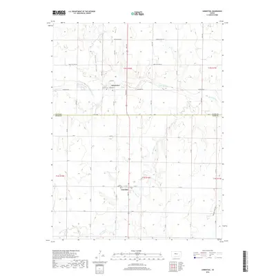
2018 Map of Liebenthal
USGS Topo · Published 2018About this map
The Smoky Hill River meanders across the northern portion of this landscape, carving a wide valley through the High Plains. Along its banks, the village of Schoenchen serves as a local hub, with Saint Anthony Cem situated on its western edge. To the south, across the Ellis Co Rush Co line, the community of Liebenthal sits near the confluence of several small drainages, including Big Timber Cr. The terrain is defined by dramatic local relief, with Lookout Hollow and Hungry Hollow breaking the steady elevation of the surrounding agricultural land. The map details a strictly gridded road system, though historical routes like Chetolah Gold Rd and Smoky Hill River Rd follow the natural contours of the river valley. For those researching local heritage, Saint Joseph Cem in Liebenthal provides a primary point of reference for the region's early families.
Find a feature on this map
47 named features on this map. Tap any name to fly to it.
Don’t see what you’re looking for? This feature index may not catch every label — zoom into the map to look around manually.
Map Details
Editions of this 2018 Liebenthal Map
This is the sole edition of this map. No revisions or reprints were ever made.
Other maps of this area

1896 · Hays
USGS Topo · 1:125,000

1955 · Great Bend
USGS Topo · 1:250,000

1957 · Great Bend
USGS Topo · 1:250,000

1958 · Great Bend
USGS Topo · 1:250,000

1961 · Hays South
USGS Topo · 1:24,000

1961 · Antonino
USGS Topo · 1:24,000

1961 · Victoria
USGS Topo · 1:24,000

1966 · La Crosse
USGS Topo · 1:24,000

1966 · Hargrave
USGS Topo · 1:24,000
1966 · Bison
USGS Topo · 1:24,000