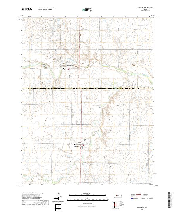
2022 Map of Liebenthal
USGS Topo · Published 2022About this map
Liebenthal and Schoenchen anchor this agricultural landscape along the northern edge of Rush County, where the plains are carved by the winding course of the Smoky Hill River. The terrain is defined by significant drainage systems, including the deep incisions of Lookout Hollow and Hungry Hollow, which break the upland plateaus. Local history is centered on the established parish communities, evidenced by the prominent locations of Saint Joseph Cem in Liebenthal and Saint Anthony Cem just south of Schoenchen. A rigid grid of section roads like 250th Ave and Ave E overlays the natural topography, though older routes like Chetolah Gold Rd and Smoky Hill River Rd follow the logic of the river valley. The confluence of Big Timber Cr and other tributaries illustrates the essential water network that supported the early settlement of these German-Russian communities.
Find a feature on this map
45 named features on this map. Tap any name to fly to it.
Don’t see what you’re looking for? This feature index may not catch every label — zoom into the map to look around manually.
Map Details
Editions of this 2022 Liebenthal Map
This is the sole edition of this map. No revisions or reprints were ever made.
Other maps of this area

1896 · Hays
USGS Topo · 1:125,000

1955 · Great Bend
USGS Topo · 1:250,000

1957 · Great Bend
USGS Topo · 1:250,000

1958 · Great Bend
USGS Topo · 1:250,000

1961 · Hays South
USGS Topo · 1:24,000

1961 · Antonino
USGS Topo · 1:24,000

1961 · Victoria
USGS Topo · 1:24,000

1966 · La Crosse
USGS Topo · 1:24,000

1966 · Hargrave
USGS Topo · 1:24,000
1966 · Bison
USGS Topo · 1:24,000