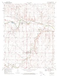
1968 Map of Liebenthal
USGS Topo · Published 1971About this map
The Smoky Hill River winds across the northern landscape of this late 1960s survey, marking a transition between the elevated terrain of Lookout Hill and the valley floor. The town of Schoenchen sits near the river bend, accompanied by St Anthony Cem, while Liebenthal is situated further south along the banks of Big Timber Creek near St Joseph Cem.
Find a feature on this map
21 named features on this map. Tap any name to fly to it.
Don’t see what you’re looking for? This feature index may not catch every label — zoom into the map to look around manually.
Map Details
Editions of this 1968 Liebenthal Map
This is the sole edition of this map. No revisions or reprints were ever made.
Other maps of this area

1896 · Hays
USGS Topo · 1:125,000

1955 · Great Bend
USGS Topo · 1:250,000

1957 · Great Bend
USGS Topo · 1:250,000

1958 · Great Bend
USGS Topo · 1:250,000

1961 · Hays South
USGS Topo · 1:24,000

1961 · Antonino
USGS Topo · 1:24,000

1961 · Victoria
USGS Topo · 1:24,000

1966 · La Crosse
USGS Topo · 1:24,000

1966 · Hargrave
USGS Topo · 1:24,000
1966 · Bison
USGS Topo · 1:24,000