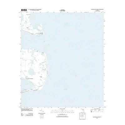
2012 Map of Lighthouse Point
USGS Topo · Published 2012About this map
Ochlockonee Bay and the coastal expanse of the Gulf of Mexico dominate this 2012 survey, revealing a landscape defined by the convergence of maritime industry and residential growth. This stretch of the Florida Panhandle coastline features significant commercial fishing sites, including the Ochlockonee Fishery and Sunday Reel Fishery, which reflect the region's enduring aquatic economy. The terrain transitions from the protected waters of Alligator Harbor to the inland freshwater bodies of Tucker Lake and Sand Pond. Residential developments such as Sun N Sand Beaches, Southern Dunes, and Sunrise Estates N are tucked behind the barrier of Bald Point, highlighting how 21st-century settlement patterns navigate the intricate network of tidal creeks and coastal ponds like Chaires Cr and Mullet Pond.
Find a feature on this map
30 named features on this map. Tap any name to fly to it.
Don’t see what you’re looking for? This feature index may not catch every label — zoom into the map to look around manually.
Map Details
Editions of this 2012 Lighthouse Point Map
This is the sole edition of this map. No revisions or reprints were ever made.
Other maps of this area

1940 · Arran
USGS Topo · 1:62,500

1943 · Arran
USGS Topo · 1:62,500

1943 · St. Teresa Beach
USGS Topo · 1:24,000

1943 · Lighthouse Point
USGS Topo · 1:24,000

1945 · Lighthouse Point
USGS Topo · 1:31,680

1945 · St Teresa
USGS Topo · 1:31,680

1949 · Apalachicola
USGS Topo · 1:250,000

1954 · Sprague Island
USGS Topo · 1:24,000

1954 · Tallahassee
USGS Topo · 1:250,000

1957 · Apalachicola
USGS Topo · 1:250,000