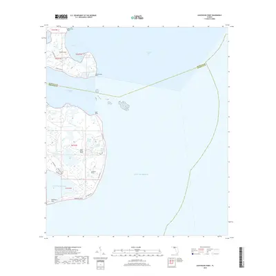
2018 Map of Lighthouse Point
USGS Topo · Published 2018About this map
Ochlockonee Bay dominates this coastal landscape where the river meets the Gulf of Mexico, defining the boundary between Wakulla and Franklin counties. The map details a complex interface of marshland, salt ponds, and sand points, including the prominent reach of Bald Point and the low-lying terrain of Saint James Island. Small residential developments like Southern Dunes are visible along the southern coastline, connected by local routes such as Bald Point Rd and Gulf Shore Blvd. This 2018 survey reveals a shore characterized by interior water bodies like Tucker Lake and Double Pond, illustrating how the hydrology of the Florida Panhandle shapes local habitation and access. The map also highlights specific landing and access spots, including Tide Creek Lndg on Mashes Island, emphasizing the area's continued reliance on the surrounding bays and coves.
Find a feature on this map
34 named features on this map. Tap any name to fly to it.
Don’t see what you’re looking for? This feature index may not catch every label — zoom into the map to look around manually.
Map Details
Editions of this 2018 Lighthouse Point Map
This is the sole edition of this map. No revisions or reprints were ever made.
Other maps of this area

1940 · Arran
USGS Topo · 1:62,500

1943 · Arran
USGS Topo · 1:62,500

1943 · St. Teresa Beach
USGS Topo · 1:24,000

1943 · Lighthouse Point
USGS Topo · 1:24,000

1945 · Lighthouse Point
USGS Topo · 1:31,680

1945 · St Teresa
USGS Topo · 1:31,680

1949 · Apalachicola
USGS Topo · 1:250,000

1954 · Sprague Island
USGS Topo · 1:24,000

1954 · Tallahassee
USGS Topo · 1:250,000

1957 · Apalachicola
USGS Topo · 1:250,000