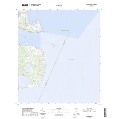
2024 Map of Lighthouse Point
USGS Topo · Published 2024About this map
Lighthouse Point and the southern reach of Saint James Island dominate this coastal survey where the Ochlockonee Bay meets the Gulf of Mexico. The landscape is a intricate network of maritime transitions, featuring coastal ponds like Sand Pond, Doublet Pond, and Mullet Pond tucked behind the shoreline of Bald Point. To the west, the protected waters of Alligator Harbor are flanked by Southwest Cape and the residential streets of Southern Dunes, including Alligator Dr and Magnolia St.
Find a feature on this map
38 named features on this map. Tap any name to fly to it.
Don’t see what you’re looking for? This feature index may not catch every label — zoom into the map to look around manually.
Map Details
Editions of this 2024 Lighthouse Point Map
This is the sole edition of this map. No revisions or reprints were ever made.
Other maps of this area

1940 · Arran
USGS Topo · 1:62,500

1943 · Arran
USGS Topo · 1:62,500

1943 · St. Teresa Beach
USGS Topo · 1:24,000

1943 · Lighthouse Point
USGS Topo · 1:24,000

1945 · Lighthouse Point
USGS Topo · 1:31,680

1945 · St Teresa
USGS Topo · 1:31,680

1949 · Apalachicola
USGS Topo · 1:250,000

1954 · Sprague Island
USGS Topo · 1:24,000

1954 · Tallahassee
USGS Topo · 1:250,000

1957 · Apalachicola
USGS Topo · 1:250,000