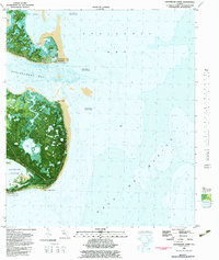
1982 Map of Lighthouse Point
USGS Topo · Published 1982About this map
St James Island dominates this coastal orthophotomap, where the interface of land and sea is constantly shifting. The topography reflects a highly dynamic environment, specifically noting an area subject to frequent change near Ochlockonee Point and the shoals of Apalachee Bay. These shifting sands and tides define the navigation of the era, as seen in the bathymetric contours reaching into the Gulf of Mexico. On the interior of the island, a network of water bodies like Tucker Lake and Sand Pond dot the marshy landscape, accessible only by a single Jeep Trail. To the south, Lighthouse Point and the Southwest Cape frame the entrance to Alligator Harbor, providing a sheltered anchorage. This detailed 1982 edition captures the transition between the freshwater ponds and the salt-heavy reaches of Ochlockonee Bay before modern development altered these shores.
Find a feature on this map
24 named features on this map. Tap any name to fly to it.
Don’t see what you’re looking for? This feature index may not catch every label — zoom into the map to look around manually.
Map Details
Editions of this 1982 Lighthouse Point Map
2 editions found
Other maps of this area

1940 · Arran
USGS Topo · 1:62,500

1943 · Arran
USGS Topo · 1:62,500

1943 · St. Teresa Beach
USGS Topo · 1:24,000

1943 · Lighthouse Point
USGS Topo · 1:24,000

1945 · Lighthouse Point
USGS Topo · 1:31,680

1945 · St Teresa
USGS Topo · 1:31,680

1949 · Apalachicola
USGS Topo · 1:250,000

1954 · Sprague Island
USGS Topo · 1:24,000

1954 · Tallahassee
USGS Topo · 1:250,000

1957 · Apalachicola
USGS Topo · 1:250,000