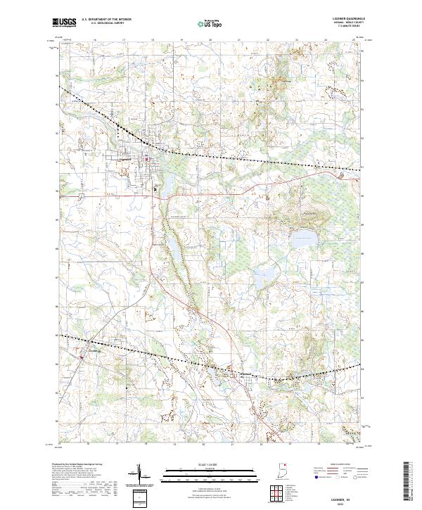
2022 Map of Ligonier
USGS Topo · Published 2022About this map
Ligonier serves as the primary hub of this Noble County landscape, where the Elkhart River and its various branches meet a grid of rural roads and historical routes. The map records the contemporary footprint of the city alongside smaller communities like Cromwell and Kimmell, which are linked by the CSX Transportation corridor. The geography is defined by a dense concentration of glacial features, ranging from the elevations of The Knobs and Diamond Hill to numerous water bodies including Diamond Lake, Eagle Lake, and the wetland area known as Red Marsh. Local heritage is anchored at Oak Park Cem and Valley Cem, while a complex drainage system of ditches and creeks, such as Smalley Ditch and Solomon Cr, illustrates the managed hydrology of this agricultural and lake-rich region of Indiana.
Find a feature on this map
98 named features on this map. Tap any name to fly to it.
Don’t see what you’re looking for? This feature index may not catch every label — zoom into the map to look around manually.
Map Details
Editions of this 2022 Ligonier Map
This is the sole edition of this map. No revisions or reprints were ever made.
Other maps of this area

1947 · Oliver Lake
USGS Topo · 1:24,000

1950 · North Webster
USGS Topo · 1:24,000

1951 · Wawasee
USGS Topo · 1:24,000

1951 · Ormas
USGS Topo · 1:24,000

1951 · Merriam
USGS Topo · 1:24,000

1953 · Fort Wayne
USGS Topo · 1:250,000

1956 · Fort Wayne
USGS Topo · 1:250,000

1956 · Ligonier
USGS Topo · 1:24,000

1956 · Albion
USGS Topo · 1:24,000

1959 · Topeka
USGS Topo · 1:24,000