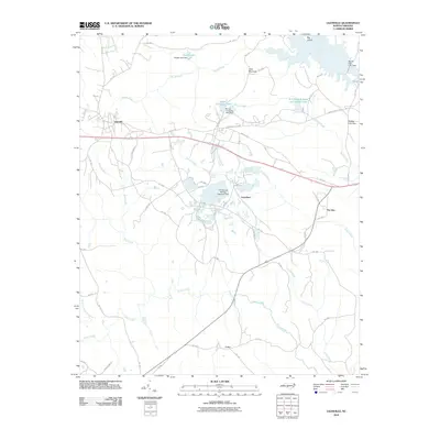
2010 Map of Lilesville
USGS Topo · Published 2010About this map
Lilesville sits at the heart of this Anson County landscape, where the terrestrial terrain meets the significant industrial and hydrological engineering of the early 21st century. The map reveals an area defined by extensive water management and resource extraction, most notably the complex of reservoirs and dams along the Pee Dee River. The eastern edge is dominated by the Blewett Falls Dam and Blewett Falls Lake Dam, while the interior shows the footprint of local industry through the B V Hedrick Sand and Gravel Lake and the W R Bonsai Tailings Reservoir Dam. These features illustrate how the natural flow of Smith Creek and McCoy Creek has been harnessed for regional utility and commerce. Small settlements like Gravelton, Pee Dee, and Cairo are linked by a network of state routes, such as NC-1825 and NC-1741, providing a clear view of the rural residential patterns surrounding Clark Mountain.
Find a feature on this map
55 named features on this map. Tap any name to fly to it.
Don’t see what you’re looking for? This feature index may not catch every label — zoom into the map to look around manually.
Map Details
Editions of this 2010 Lilesville Map
This is the sole edition of this map. No revisions or reprints were ever made.
Other maps of this area

1941 · Spartanburg
USGS Topo · 1:250,000

1942 · Troy
USGS Topo · 1:125,000

1942 · Rockingham
USGS Topo · 1:125,000

1953 · Florence
USGS Topo · 1:250,000

1953 · Raleigh
USGS Topo · 1:250,000

1953 · Spartanburg
USGS Topo · 1:250,000

1953 · Charlotte
USGS Topo · 1:250,000

1954 · Charlotte
USGS Topo · 1:250,000

1954 · Florence
USGS Topo · 1:250,000

1954 · Raleigh
USGS Topo · 1:250,000