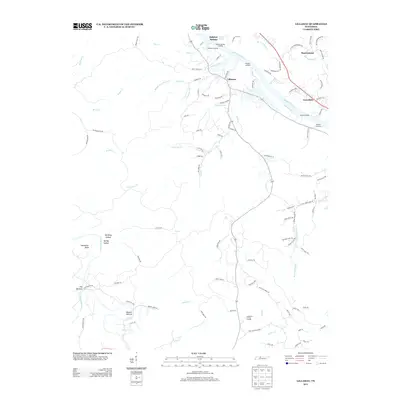
2013 Map of Lillamay
USGS Topo · Published 2013About this map
The Cumberland River and its dramatic northern bends define this portion of the Tennessee landscape, where river commerce was historically managed through numerous points such as Shearons Landing, Hoopers Landing, and Barton Landing. In the southwest corner, the Harpeth River creates a remarkable tight loop at Horseshoe Bend and the neck of land known as The Narrows. This area is home to Mound Bottom, a significant cultural site situated in a bend of the river.
Find a feature on this map
101 named features on this map. Tap any name to fly to it.
Don’t see what you’re looking for? This feature index may not catch every label — zoom into the map to look around manually.
Map Details
Editions of this 2013 Lillamay Map
This is the sole edition of this map. No revisions or reprints were ever made.
Other maps of this area

1903 · Nashville
USGS Topo · 1:125,000

1930 · White Bluff
USGS Topo · 1:62,500

1931 · Ridgetop
USGS Topo · 1:62,500

1932 · Nashville
USGS Topo · 1:62,500

1933 · White Bluff
USGS Topo · 1:62,500

1935 · Ridgetop
USGS Topo · 1:62,500

1955 · Forest Grove
USGS Topo · 1:24,000

1955 · Scottsboro
USGS Topo · 1:24,000
1955 · Belleview
USGS Topo · 1:24,000

1956 · Nashville
USGS Topo · 1:250,000