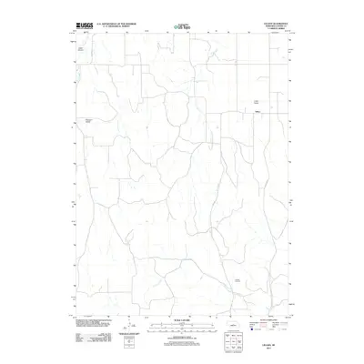
2011 Map of Lillian
USGS Topo · Published 2011About this map
Lillian Valley and the small community of Lillian characterize this Custer County landscape, where agriculture and cattle ranching are shaped by the intermittent drainages of the Nebraska Sandhills. The terrain transitions from the high ground of Cedar Canyon in the northwest to the more open Pleasant Valley, with the southern portion of the quadrangle defined by the meandering course of Lillian Creek. The road network is sparse, including Gates Co Rd and local routes like St Spr 21 A, which connect isolated farmsteads across the prairie. For genealogists and local historians, the Hilldale Cemetery serves as a primary landmark in the southeast, anchoring the history of the families who settled this part of the Central Nebraska loess hills. The map captures the persistent rural character of the region, where water remains the critical factor, as seen in the seasonal flows of Victoria Creek and Dry Creek.
Find a feature on this map
11 named features on this map. Tap any name to fly to it.
Don’t see what you’re looking for? This feature index may not catch every label — zoom into the map to look around manually.
Map Details
Editions of this 2011 Lillian Map
This is the sole edition of this map. No revisions or reprints were ever made.
Other maps of this area

1951 · Broken Bow NE
USGS Topo · 1:24,000

1951 · Lillian
USGS Topo · 1:24,000

1951 · Anselmo
USGS Topo · 1:24,000

1951 · Broken Bow
USGS Topo · 1:24,000

1951 · Merna
USGS Topo · 1:24,000

1951 · Walworth
USGS Topo · 1:24,000

1951 · Anselmo NE
USGS Topo · 1:24,000

1951 · Round Valley
USGS Topo · 1:24,000

1951 · Milburn
USGS Topo · 1:24,000

1955 · Broken Bow
USGS Topo · 1:250,000