
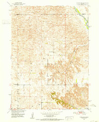
1951 Map of Anselmo NE
USGS Topo · Published 1953About this map
Middle Loup River winds through the northeast corner of this central Nebraska landscape, defining a sharp boundary between Blaine and Custer Counties. Surveyed in the early 1950s, the terrain is characterized by intricate landforms and numerous canyons, most notably River Canyon and Cedar Canyon. This area of the Sandhills transition shows a sparse but organized rural infrastructure, with life revolving around scattered schools and water sources. Educational hubs like Happy Hollow School, Cooperville School, and Windy Point School are positioned to serve the remote townships of Edith and Victoria. The reliance on groundwater is evident by the high density of windmills dotting the landscape, while the presence of the Victoria Springs Cemetery in the southeast suggests a long-standing community footprint near the canyon breaks.
Find a feature on this map
11 named features on this map. Tap any name to fly to it.
Don’t see what you’re looking for? This feature index may not catch every label — zoom into the map to look around manually.
Map Details
Editions of this 1951 Anselmo NE Map
3 editions found
Other maps of this area

1951 · Lillian
USGS Topo · 1:24,000

1951 · Anselmo
USGS Topo · 1:24,000

1951 · Anselmo SW
USGS Topo · 1:24,000

1951 · Anselmo NW
USGS Topo · 1:24,000

1951 · Milburn
USGS Topo · 1:24,000

1952 · Almeria SW
USGS Topo · 1:24,000

1952 · Brewster SE
USGS Topo · 1:24,000

1952 · Brewster SW
USGS Topo · 1:24,000

1955 · Broken Bow
USGS Topo · 1:250,000

1956 · Broken Bow
USGS Topo · 1:250,000