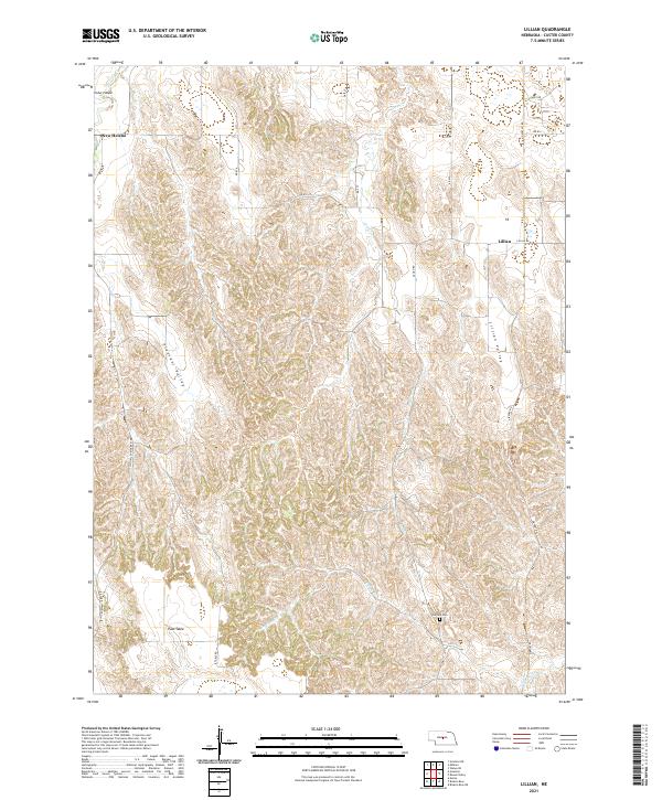
2021 Map of Lillian
USGS Topo · Published 2021About this map
Pleasant Valley and Lillian Valley define the drainage patterns of this central Nebraska landscape, where the broken terrain of Cedar Canyon meets the flatter expanse of the East Table. This 2021 survey shows a rural environment where land use is dictated by the deeply etched watercourses of Victoria Cr and Lillian Cr. Small settlements like New Helena and Lillian remain as anchor points for a network of country roads, including Gates Rd and Lillian Rd.
Find a feature on this map
27 named features on this map. Tap any name to fly to it.
Don’t see what you’re looking for? This feature index may not catch every label — zoom into the map to look around manually.
Map Details
Editions of this 2021 Lillian Map
This is the sole edition of this map. No revisions or reprints were ever made.
Other maps of this area

1951 · Broken Bow NE
USGS Topo · 1:24,000

1951 · Lillian
USGS Topo · 1:24,000

1951 · Anselmo
USGS Topo · 1:24,000

1951 · Broken Bow
USGS Topo · 1:24,000

1951 · Merna
USGS Topo · 1:24,000

1951 · Walworth
USGS Topo · 1:24,000

1951 · Anselmo NE
USGS Topo · 1:24,000

1951 · Round Valley
USGS Topo · 1:24,000

1951 · Milburn
USGS Topo · 1:24,000

1955 · Broken Bow
USGS Topo · 1:250,000