
1973 Map of Lily
USGS Topo · Published 1976About this map
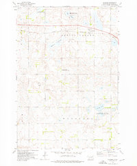
The town of Lily serves as the central hub of this prairie landscape, situated at the intersection of local township lines and the Chicago Milwaukee St Paul and Pacific railroad line. The settlement pattern is defined by rural homesteads and several community landmarks, including St Josephs Cem and Hillside Cem just outside the town limits. Further south near the Day Co Clark Co line, West Saviors Cem and Our Saviors Cem point to the early religious and social foundations of the area.
Find a feature on this map
23 named features on this map. Tap any name to fly to it.
Don’t see what you’re looking for? This feature index may not catch every label — zoom into the map to look around manually.
Map Details
Editions of this 1973 Lily Map
This is the sole edition of this map. No revisions or reprints were ever made.
Other maps of this area

1953 · Milbank
USGS Topo · 1:250,000

1958 · Milbank
USGS Topo · 1:250,000

1973 · Webster
USGS Topo · 1:24,000

1973 · Bristol West
USGS Topo · 1:24,000

1973 · Swan Lake
USGS Topo · 1:24,000

1973 · Bradley
USGS Topo · 1:24,000

1973 · Lone Tree Lake
USGS Topo · 1:24,000

1973 · Bristol East
USGS Topo · 1:24,000

1973 · Heggs Lake
USGS Topo · 1:24,000
1973 · Crocker
USGS Topo · 1:24,000